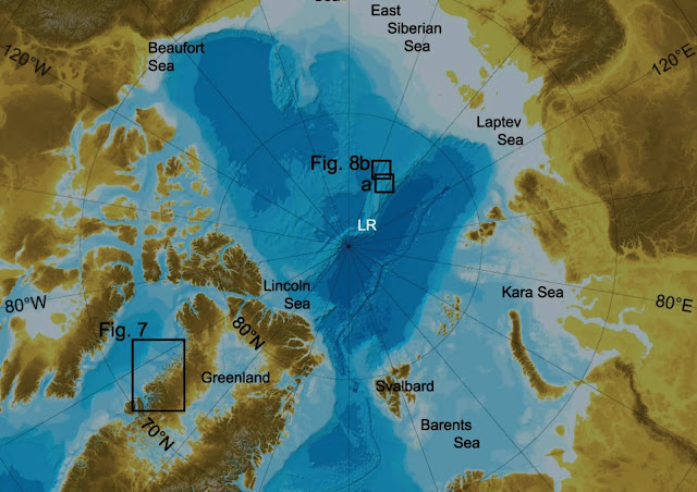
In order to study the shape and depth of the seabed of Arctic Ocean, a group of scientists from Europe, United States, Canada, South Korea, China, and Greenland have recently developed a detailed Bathymetric Map of the Northern Ocean, commonly known as Arctic Ocean. This is a part of the global project which aims to map the seabed of the whole world.
This initiative is known as International Bathymetric Chart of the Arctic Ocean (IBCAO), and the map provides a more detailed visual than that of the map previously developed in 2012. The main objective of this initiative is to develop a digital database, which will contain all Bathymetric data of the area of north pole from 64°N.
The study has been carried out by Martin Jakobsson and other researchers. They reported their findings through the paper entitled as "The International Bathymetric Chart of the Arctic Ocean Version 4.0", in the journal Scientific Data.
 |
| International Bathymetric Chart of the Arctic Ocean | Image Courtesy: M. Jakobsson, et. al., DOI: https://doi.org/10.1038/s41597-020-0520-9 |
This new Bathymetric Map of the Arctic Ocean, or the International Bathymetric Chart of the Arctic Ocean is this year's contribution to the GEBCO Seabed 2030, whose goal is to map the whole seabed of the Earth by 2030.
The scientists have contributed to the map by providing the datasets, especially of the western part in the Barents Sea, which was obtained through the multibeam bathymetry in the oceanographic campaign in the Arctic Ocean.
It seems to be quite challenging for oceanographic studies in the frozen Arctic Ocean. Hence the data obtained by some oceanography vessels, nuclear submarines, ice breaker, and others.
Findings
The bathymetric map provides many morphological information of ocean floor which naturally provides a whole new insight of different marine process and features deep into the ocean. It can be mentioned as an instance that, the exalted imagery of the Greenland fjords would provide a better description about the upshot of the Greenland Ice Sheet.
According to the scientists, the modern and neo cartographic techniques help to amplify the knowledge of the glacial and geological evolution of the Arctic region. The new bathymetric map provides us lots of information, such as a number of relief features with glacial origin, or sometimes with the direction of the movement of oceanic ice sheets. This could help the scientists to reform the geological history of the Arctic region.
Relevancy of such Bathymetric Maps
Such kind of bathymetric databases are very much useful to study the path of ocean current, declination of oceanic ice sheets, distribution of heat in ocean water, stability of oceanic ice streams, outlet glaciers, and many other branches of polar science.
In this regard, it is important to mention that one of the most interesting feature deep into the Arctic Ocean is the Lomonosov Ridge. It is almost 1,800 kilometres long oceanic ridge that extents between Russia and Northern Greenland. This ridge divides the Arctic ocean basin into two broad parts- Eurasian Basin, and Amerasian Basin. The recently conducted cartographic study reveals the existence of thresholds that makes a way to exchange the water between these two basins.

Post a Comment
Please do not enter any spam link in the comment box